Geophysics in Baton Rouge encompasses a suite of non-invasive subsurface investigation techniques essential for characterizing soil and bedrock conditions without extensive excavation. In a city defined by its position along the Mississippi River and its complex alluvial geology, these methods provide critical data where traditional drilling alone falls short. By measuring variations in physical properties like electrical conductivity, seismic velocity, and dielectric permittivity, geophysical surveys map stratigraphy, locate voids, and assess material stiffness. For engineers and developers in Louisiana's capital, integrating these methods early in a project lifecycle is not a luxury but a fundamental step toward mitigating risks associated with the region's notoriously challenging soils.
The local geology of Baton Rouge is dominated by Quaternary alluvium and the underlying, undulating contact with the Plio-Pleistocene Citronelle Formation. The near-surface sediments consist of interbedded clays, silts, and sands deposited by the ancient meanders of the Mississippi River, creating a laterally discontinuous and heterogeneous subsurface. A critical consequence of this depositional environment is the presence of soft, compressible clays and liquefiable sands, conditions that directly influence seismic site amplification and foundation settlement. Understanding this complex framework demands high-resolution tools like GPR (Ground Penetrating Radar) surveys, which excel at delineating sedimentary structures and buried stratigraphic contacts in the shallow subsurface, though their penetration depth is often limited by the electrically conductive clays prevalent in the area.
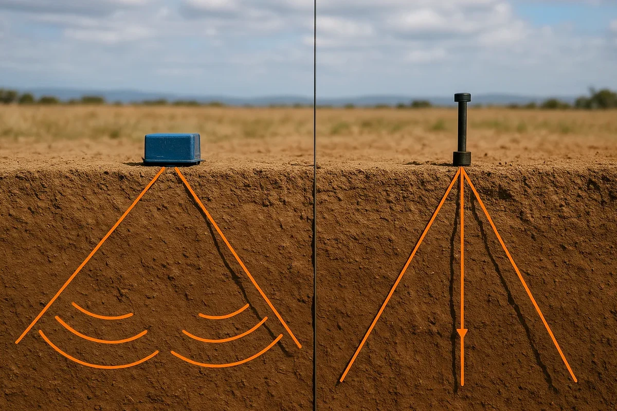
Regulatory compliance in Louisiana, specifically through the Louisiana Uniform Construction Code (LUCC) which adopts the International Building Code (IBC), mandates site-specific seismic hazard assessments for critical structures. Given Baton Rouge's location in a region susceptible to long-period ground motion amplification from distant seismic events, the IBC requires Site Class determination (A through F) based on the average shear wave velocity in the upper 30 meters (Vs30). This is where a targeted MASW / Vs30 survey becomes indispensable, providing a direct, non-invasive measurement of soil stiffness that satisfies code requirements and informs structural engineers about potential seismic response. Furthermore, environmental regulations under the Louisiana Department of Environmental Quality (LDEQ) often require subsurface characterization for brownfield redevelopment, where geophysics aids in delineating buried waste or contaminant plumes without disturbing hazardous materials.
These geophysical methods are not confined to a single project type but are woven into the fabric of Baton Rouge's infrastructure and development. Major highway expansions, such as those on I-10 and I-12, rely on continuous seismic tomography (refraction/reflection) for mapping rippability and bedrock topography along proposed alignments. For the construction of mid-rise and high-rise structures in the downtown medical district, a combined approach is typical: a HVSR microtremor survey (Nakamura method) provides a rapid, passive measurement of the fundamental site period, which is then calibrated with an active-source MASW survey for a robust Vs30 profile. This integrated workflow directly addresses the risk of resonance effects in tall structures founded on deep, soft soil basins.
Common questions
What is the primary benefit of using geophysics over just drilling boreholes in Baton Rouge?
Boreholes provide data at a single point, but Baton Rouge's alluvial geology is highly variable laterally. Geophysical methods bridge the gap between boreholes, creating a continuous 2D or 3D profile of the subsurface. This identifies hazards like paleochannels, buried debris, or abrupt changes in soil stiffness that a spaced grid of borings could easily miss, leading to a more robust and defensible ground model.
Which geophysical method is best for determining seismic site class in Louisiana?
The Multichannel Analysis of Surface Waves (MASW) is the industry-standard method for directly measuring Vs30, the parameter used by the IBC to define Site Class. It is often paired with the Microtremor Horizontal-to-Vertical Spectral Ratio (HVSR) method. This combination provides both a velocity-depth profile and the fundamental site period, offering a comprehensive assessment of seismic amplification potential in the deep soils of Baton Rouge.
Can geophysical surveys help locate old infrastructure or sinkhole risks in Baton Rouge?
Yes, this is a common application. Ground Penetrating Radar (GPR) is highly effective for locating buried utilities, old foundation remnants, and subsurface tanks. For deeper karst features or voids in the underlying Citronelle Formation, which can lead to sinkhole development, electrical resistivity tomography or seismic tomography are more appropriate due to their greater depth of investigation.
What are the limitations of conducting geophysical surveys in an urban environment like downtown Baton Rouge?
Urban noise from traffic and machinery can significantly degrade seismic data quality, making passive methods like HVSR challenging during daytime hours. Electromagnetic interference from power lines and reinforced concrete also limits the effectiveness of GPR and electrical methods. An experienced geophysicist mitigates these by using shielded antennas, performing night-time data acquisition, and carefully processing data to filter out coherent noise.