Baton Rouge sits at an elevation of about 17 meters above sea level, yet its subsurface — dominated by Mississippi River alluvial deposits — can shift dramatically within a single city block. We design and install geotechnical instrumentation systems that capture real-time pore pressure, lateral earth movement, and settlement data, giving project teams the confidence to build on this challenging ground. Complementing these monitoring networks with a [MASW survey](/masw-vs30/) helps us correlate shear wave velocity profiles with instrument readings for a more complete site picture, while inclinometer data validates ground movement predictions against actual field behavior.
In Baton Rouge’s alluvial soils, automated piezometers caught a 40% pore pressure rise within six hours of heavy rainfall — data that saved a cofferdam from overtopping.
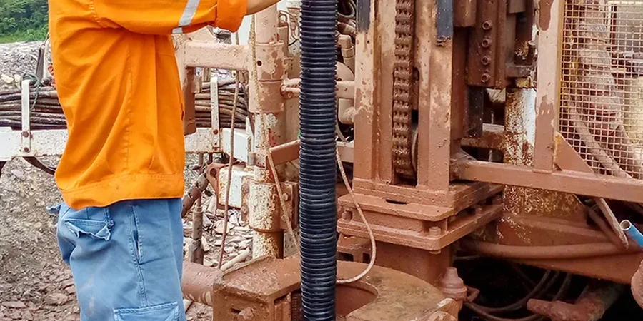
Method and coverage
Regional considerations
In the Garden District, where stiff Pleistocene clays sit near the surface, geotechnical instrumentation often confirms negligible movement. Cross the line into South Baton Rouge, though, and the Holocene backswamp clays can produce 50 mm of settlement under a modest fill load — something we’ve measured with real-time settlement profilers on several school projects. The risk isn’t just magnitude; it’s rate. Without continuous monitoring, a slow-moving failure in these plastic clays can go undetected until structural cracks appear. That’s why we install dual-purpose inclinometer-piezometer strings along sensitive excavations and levee alignments across the parish.
Standards that apply
ASTM D6230-21 (Inclinometer), ASTM D5092-16 (Piezometer Installation), ASCE 7-22 (Earth Loads & Site Class)
Associated technical services
Automated Pore Pressure Monitoring
Vibrating wire piezometers installed in sealed zones with dedicated dataloggers. We calibrate each sensor against local hydrostatic conditions and provide weekly reports with trend analysis.
Inclinometer & Settlement Arrays
Vertical inclinometer casings grouted into boreholes with settlement plates at grade. Surveys are conducted to ASTM D6230 standards with data reduction that isolates shear deformation from rotation.
This service complements our laboratory testing work for a complete project analysis.
Typical parameters
Common questions
What is the typical cost range for a geotechnical instrumentation program in Baton Rouge?
For a standard project including three vibrating wire piezometers, two inclinometer casings, and a datalogger with cellular telemetry, the installed cost typically ranges between US$2,740 and US$3,830. This includes sensor calibration, field installation, data cabling, and one month of automated data collection.
Which soil types in Baton Rouge require the most intensive instrumentation?
The high-plasticity clays (CH) and organic silts (OH) found in the Alluvial Plain near the Mississippi River demand the most attention. These materials exhibit significant consolidation settlement and can develop excess pore pressures that linger for months. We typically specify vibrating wire piezometers at 3 m intervals and settlement plates at grade for fills exceeding 3 m.
How long does it take to install a full geotechnical monitoring system?
A typical array of three piezometers, two inclinometer casings, and one settlement plate can be installed in two to three field days, assuming dry weather and accessible boreholes. Data logging begins immediately after the sensors are saturated and the datalogger is programmed. We coordinate with the drilling crew to minimize downtime between borehole completion and instrument placement.
What is the difference between an open standpipe piezometer and a vibrating wire piezometer?
An open standpipe measures groundwater level via a water column in a slotted PVC pipe; it is simple but slow to respond to rapid pressure changes. A vibrating wire piezometer uses a tensioned wire whose resonant frequency changes with pore pressure, providing near-instantaneous readings that are ideal for monitoring construction-induced pore pressure changes in Baton Rouge's low-permeability clays.