Sitting on the Mississippi River's alluvial deposits, soils in Baton Rouge's Garden District can feel like firm clay while those near the LSU lakes shift into soft silt just a few blocks away. That variability makes the HVSR microtremor survey a first-line tool for understanding how the ground will shake during an earthquake. Instead of drilling or generating waves, we deploy a single three-component seismometer that records ambient vibrations for about 30 minutes. The Nakamura method isolates the horizontal-to-vertical spectral ratio, revealing the fundamental resonance frequency of the soil column. In Baton Rouge, where deep Quaternary sediments overlay bedrock at 200–300 meters, this survey helps us identify whether a building site sits on a stiff ridge or a soft basin that could amplify seismic motion. We often pair it with a MASW-Vs30 survey to cross-check shear-wave velocity profiles, and when the building code requires site-specific response analysis, we combine the results with a response spectrum study for full compliance.
A sharp H/V peak in Baton Rouge often indicates soft clay over dense sand, a classic impedance contrast that can double ground motion at the building's natural period.
Method and coverage
Regional considerations
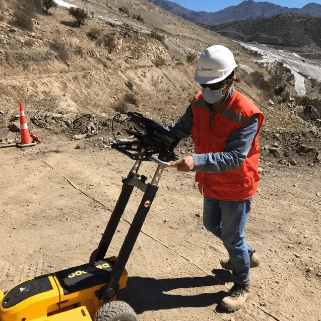
The instrument we use for the HVSR microtremor survey looks unassuming: a small black cylinder about the size of a coffee can, connected by cable to a digital recorder. But that little sensor is sensitive enough to pick up a person walking 20 meters away. In Baton Rouge, where the ground is soft and wet much of the year, we bury the sensor a few centimeters into the soil to avoid wind-induced noise. If we set it on grass, we clear the turf first to get a firm contact. The risk of a bad reading comes from nearby machinery, passing trucks on I-10, or even children playing near the setup. We ask the client to give us a quiet window of about an hour per station. A contaminated record with lots of transient noise can produce false peaks that look like a soil resonance but are actually traffic or wind. Our processing software flags those windows automatically, but an experienced operator on site makes the call to re-run a station if needed. In one project near the Mississippi River levee, we had to wait for a barge to pass because its engine vibrations matched the soil's natural frequency, drowning out the signal.
Process video
This service complements our laboratory testing work for a complete project analysis.
Standards that apply
SESAME (2004) — Guidelines for the Implementation of the H/V Spectral Ratio Technique, ASCE 7-22 — Minimum Design Loads for Buildings and Other Structures (site class determination), NEHRP Recommended Seismic Provisions (site class based on Vs30 or H/V peak frequency)
Associated technical services
Single-Station HVSR Survey
One 30–60 minute recording at a critical location (e.g., building footprint corner). Provides the fundamental frequency and H/V peak amplitude for basic site classification per ASCE 7. Ideal for small residential projects or preliminary screening.
Multi-Station Grid Survey
A 2D array of 5–20 stations spaced 20–50 meters apart across the site. Generates a contour map of resonance frequencies, revealing lateral variability such as buried channels or soft zones. Recommended for subdivisions, schools, and commercial buildings in Baton Rouge.
Integrated Seismic Site Response
Combines HVSR data with MASW or SPT results to build a full 1D or 2D soil model. Output includes design response spectra per ASCE 7, amplification factors, and liquefaction triggering analysis. Required for essential facilities and high-occupancy buildings.
Typical parameters
Common questions
How does the HVSR microtremor survey work in Baton Rouge's soft soils?
The sensor records ambient vibrations from natural and human sources. The Nakamura method computes the ratio of horizontal to vertical motion. In Baton Rouge's soft alluvial soils, the H/V curve typically shows a clear peak between 0.5 and 2 Hz, indicating the soil's fundamental resonance frequency. This tells us how the ground will amplify earthquake waves.
What is the typical cost for an HVSR survey in Baton Rouge?
A single-station survey in Baton Rouge usually ranges between $1,490 and $2,740, depending on site accessibility, number of stations, and whether you need a full report with site class recommendations. Multi-station grids are priced per station with volume discounts.
Can HVSR replace a standard geotechnical boring for seismic design?
No, the HVSR survey complements but does not replace borings or SPT. It provides the soil's dynamic response (frequency and amplification), not strength or soil type. For ASCE 7 site classification, you still need shear-wave velocity data, which we obtain from MASW or cross-hole testing. The HVSR survey helps target where to drill.
How long does the field work take and when do I get results?
Each station takes about one hour to set up, record, and pack. A 10-station grid can be done in one long day. Preliminary H/V curves are available within 24 hours. The full report with interpretation, site class, and recommendations is delivered within one week.